Valley of the Seven Lakes, Slovenia: Complete Hiking Guide

The Valley of the Seven Lakes Hike in Slovenia is one of the best hikes I’ve ever done. I planned my whole Slovenia trip around it, and it was so worth it! The scenery was absolutely incredible. Here is a complete guide to the Valley of the Seven Lakes hike in Triglav National Park, Slovenia, including how to get to the trailhead, what to expect on the hike, answers to common questions, and all my best advice for doing it.
Contents

Valley of the Seven Lakes: Hike Stats
Distance: 25km
Elevation gain: 1450m
Time: 9-11 hours
Valley of the Seven Lakes Hike Overview
The Valley of the Seven Lakes hike is a trail that takes you through Triglav National Park and passes by seven beautiful lakes with crystal clear water. You can either do it in one big day or split it into two days by staying in one of the many huts along the trail. Note that many of the huts are only open in the summer months, so check their websites for confirmation, and make sure you book in advance. Doing the Valley of the Seven Lakes hike in one day is absolutely doable if you start early and are prepared with plenty of water and food. It’s a long day but worth every second!

How to get to the Trailhead of the Valley of the Seven Lakes Hike by Car
The trailhead of the Valley of the Seven Lakes Hike is at Planina Blato. To get to this point, you will need to enter a private road system which takes you up into the mountains. To enter the private road, you need to pass through electronic barriers next to Mostnica Trailhead Parking in Stara Fuzina, where you will get a ticket. On your way out, you will pay the charge of €20 to open the barrier. You can pay with cash or card. This is cheaper than paying for parking in the parking lot next to the private road entrance, which charges €3 per hour, and allows you more flexibility. It is a paved road until the very end where it becomes gravel, and there is free parking at the end. Towards the end, you will start to see signs telling you to park. As soon as these signs start, you are not far from the actual trailhead, so you can park anywhere.
How to get to the Trailhead of the Valley of the Seven Lakes Hike by Bus
If you don’t have a car, you can get to the trailhead of the Valley of the Seven Lakes hike by bus, but this is only an option in the summer months, as the shuttle buses end in late September. You will first need to get a bus from Bohinj to the Mostnica Trailhead Parking. Here, you will change buses to the shuttle which takes you up the road to Planina Blato. Because of the popularity of this hike and because it is long, you will want to be on the first shuttle bus up, before 7am. If you are in Slovenia without a car, you will therefore need to be staying in Stara Fuzina or Bohinj to access the Valley of the Seven Lakes hike without a car.
The distance from the parking at Mostnica to Planina Blato is about 6km with 650m of elevation gain, so I do not recommend hiking this on top of the hike itself! There are no views on it either - it is through a forest.

What to Expect on the Valley of the Seven Lakes Hike
The start of the Valley of the Seven Lakes hike trail is quite obvious: you’ll see a red sign to mark it at Planina Blato. However, there are no signs along the trail that say ‘Valley of the Seven Lakes’, so I recommend downloading an offline map on All Trails to ensure you are taking the right path. There is very limited service in the mountains, so having this offline is essential.
The red signs you’ll see along the Valley of the Seven Lakes hike point you in the direction of specific lakes, meadows, huts, and peaks. Along the trail itself, there are red and white dots and red lines on trees and rocks as trail markings for you to follow. At all crossroads there are signs. Here are the key signs you need to follow on the Valley of the Seven Lakes hike, plus what to expect at each stage.

The first sign to follow is for Planini pri Jezeru, which is where the first lake is. The trail starts quite steep, heading up through the forest. This is the steepest part of the trail. The first lake is next to a collection of huts, including one you can stay in. It is absolutely stunning, although the sun is on it from midday to early afternoon, so it may not be lit up if you’ve started early. Don’t worry though, you will pass by again on your way down!
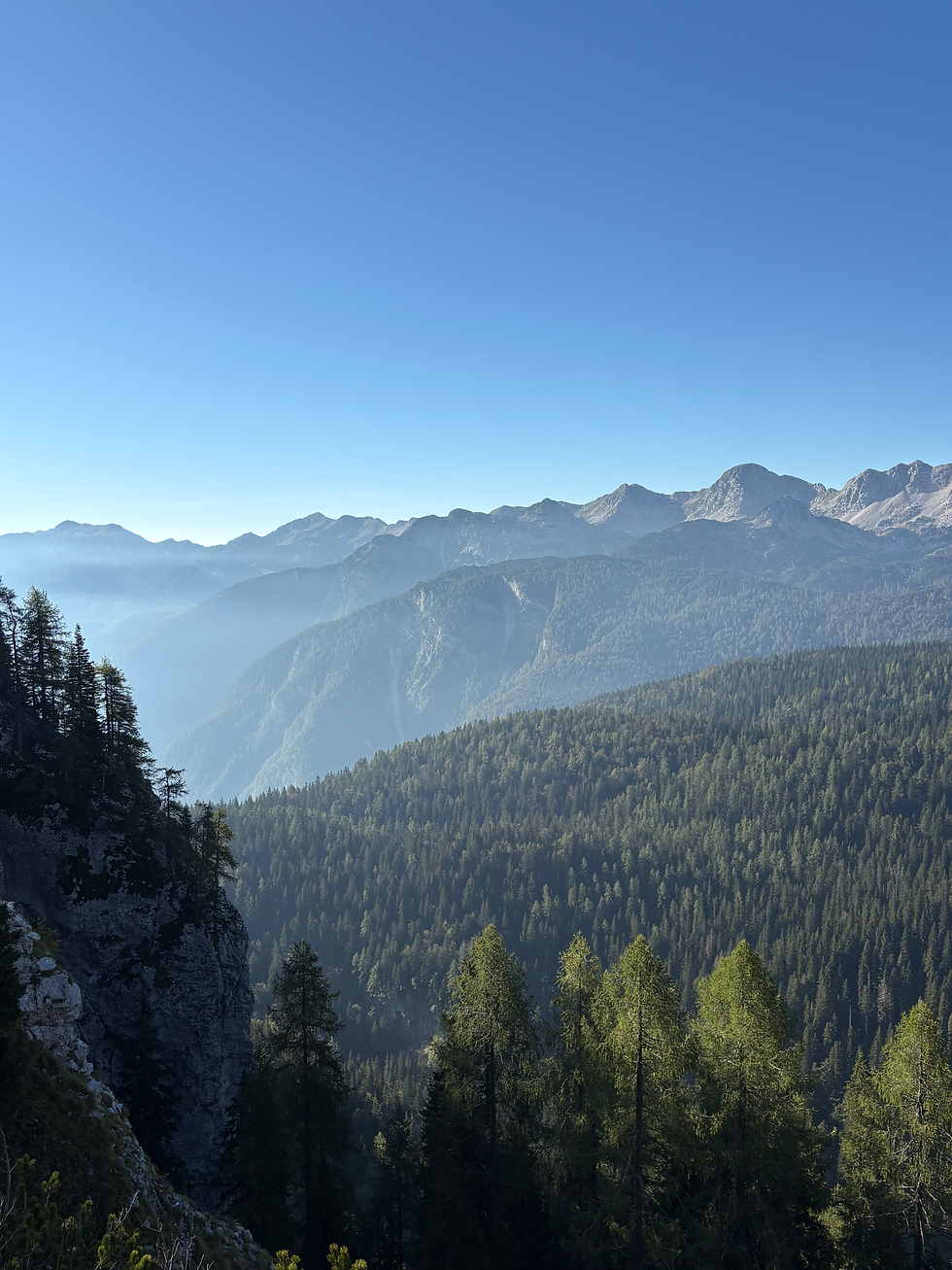
On your way down to the first lake, you will turn off to the left and follow signs to Planina Visevnik and then to Planina Ovcarija. You will go through another small collection of huts and then along a forested trail until it opens up to the most incredible views of the Julian Alps. In the morning light, this was amazing.
From here, you will need to follow the signs to Koča pri Triglavskih Jezerih, which is a hut by the double lake. This was one of my favourite parts of the whole Valley of the Seven Lakes hike. There are two beautiful lakes in such a calm and quiet setting, and the hut next to the lakes is very picturesque. There is a toilet at this hut (providing it is open) and an outdoor tap to fill up your water if needed, although I recommend a filtered bottle.
You will then walk past this hut and hike uphill through a valley to Jezero v Ledvicah which is another lake, one of the largest on the hike, and is gorgeous. As you walk along the side of the lake and beyond it, make sure you turn around and look back down the valley for one of my favourite views on the Valley of the Seven Lakes hike!

The next lake you’ll then pass is Zeleno Jezero, which is in the rocky section of the Valley of the Seven Lakes hike. After passing this lake, you will climb up to the hut, following signs for Prehodavich. The view from here is unreal, with 360-degree views of the mountains, and it’s the perfect place to have lunch or a rest. There is a toilet outside this hut too.
Heading back down to Zeleno Jezero, you will turn left and head up a gravelly traverse along the side of the mountain. It’s the last uphill section of the Valley of the Seven Lakes hike, and it’s slightly more challenging because the trail is harder to walk on with all of the loose rocks.

Once you hit the next crossroads, you’ll start your descent on the other side of the mountain. You will feel your feet and legs at this point, but you will soon hit the treeline and find yourself eventually back at the first lake where you can relax in the meadow or in the hut there. It is a really beautiful spot.
The last section of the Valley of the Seven Lakes hike is the same as the first, and you will head down to Planina Blato.

Do you need a map for the Valley of the Seven Lakes Hike?
Yes, you need to have an offline map downloaded for the Valley of the Seven Lakes hike. The service in the mountains is very sporadic, and there are numerous occasions where you will come across crossroads where you could go wrong. The signs along the route are helpful if you know what to look for, but they are only in Slovenian and point to named places that you will likely not recognise.
How fit do you need to be for the Valley of the Seven Lakes Hike?
The Valley of the Seven Lakes hike is a long hike with significant elevation gain, so you need to have a good level of fitness to complete this hike and be able to enjoy it, especially if you do it in one day.

What do you need to bring on the Valley of the Seven Lakes Hike?
The Valley of the Seven Lakes hike is physically demanding and in the mountains, which means you need to be prepared. Here is a list of things you need to bring on the Valley of the Seven Lakes hike:
Water: you will need plenty of water as there are limited places to fill up your bottle during the hike. I would recommend a filtered water bottle to be safe filling up from taps around huts.
Snacks and lunch: food is essential as you will be burning thousands of calories on this hike and you need to fuel yourself!
Suncream: most of the Valley of the Seven Lakes hike is very exposed, meaning you will need suncream, sunglasses, and other sun protection.
Waterproofs and layers: weather in the mountains changes quickly, so make sure you have waterproofs and layers in case you are caught out.
Portable charger: as you will need to navigate this hike using an offline map with a GPS tracker, you need to make sure your phone does not run out of battery. Bring a portable charger.
Hiking boots: a good pair of hiking boots with ankle support is essential for the Valley of the Seven Lakes hike. The trail is uneven and can be slippery at times, so make sure you have enough stability in your footwear.

When is the best time to do the Valley of the Seven Lakes Hike?
The best time to do the Valley of the Seven Lakes hike is in the summer. In the summer months (June-August), the huts are open, shuttle buses run to the trailhead, and you have more chance of hiking in good weather. September is also a great month to do the Valley of the Seven Lakes hike, but make sure you have access to a car if you do this.
Can you swim in the lakes on the Valley of the Seven Lakes Hike?
No, you cannot swim in the lakes on the Valley of the Seven Lakes hike. They are protected ecosystems and swimming is forbidden. Please respect this!

I hope this is a helpful guide to the Valley of the Seven Lakes hike. It was the highlight of my trip to Slovenia and I recommend it to anyone who goes. As always, make sure you take care of the environment you hike through: take all your rubbish home with you, respect the no-swimming rules, and make sure you only leave your footprints behind :)
Looking for more hiking guides? See some of my others here!


Comments