The Best Day Hikes on New Zealand’s South Island: From Easy to Epic
- Margaux

- Feb 22
- 8 min read
I spent a month backpacking New Zealand’s South Island, and did a hike almost every day. This post gives you a guide to the best hikes on New Zealand’s South Island, including what they are like, where the trailheads are, and their difficulty rating.
The best time of year to hike on New Zealand’s South Island is summer, between November and March, and in November and December, you might be lucky enough to see the infamous lupins, especially around Lake Tekpo. Weather in the mountains is always unpredictable, however, so be prepared for all eventualities and pack rain gear, plenty of water, and snacks. The hiking trails around New Zealand are all incredibly well maintained, so well that you probably don’t need hiking boots for most of them, and trainers or walking shoes with good grip will suffice. However, for longer, more high altitude hikes, I always recommend hiking boots.
For a complete guide to backpacking New Zealand’s South Island, see my post here.

Contents
The Best Day Hikes on New Zealand’s South Island: Summary
Hike | Location | Distance | Time | Difficulty | Car-free Access? |
|---|---|---|---|---|---|
Hooker Valley Track | Mt Cook | 10.9km (out and back) | 2-3 hours | Easy | No |
Mt John | Lake Tekapo | 8.4km (circular) | 3-4 hours | Easy | Yes |
Glendhu Bay | Wanaka | 20.2km (out and back) | 5-6 hours | Easy - Moderate | Yes |
Forest Walk and Sentinel Rock | Franz Josef | 2km (out and back) | 30 mins - 1 hour | Easy | Yes |
Queenstown Hill | Queenstown | 5km (out and back) | 2-3 hours | Easy - Moderate | Yes |
Mt Luxmore from Brod Bay | Te Anau | 25.3km (out and back) | 5-7 hours | Moderate - Difficult | Yes |
Abel Tasman Coastal Track: Bark Bay - Marahau | Abel Tasman National Park | 24.6km (point to point) | 7-9 hours | Moderate | Yes |
Roy’s Peak | Wanaka | 16.4km (out and back) | 6-7 hours | Difficult | No |
Ben Lomond | Queenstown | 12.7km | 5-7 hours | Difficult | Yes |
The Best Easy Day Hikes on New Zealand’s South Island
Hooker Valley Track: Mt Cook National Park
Distance: 10.9km (out and back)
Time: 2-3 hours
Elevation gain: 214m
Car-free access? No
Although busy, the Hooker Valley track is unreal. You will need to either drive or get a tour (if you don’t have a car) to the trailhead. The track is not strenuous at all, and takes 2-3 hours depending on your speed and how long you spend at Hooker Lake at the end of the trail. It crosses rivers and has incredible views of Mt Cook itself. It is definitely up there with the most stunning hikes I have ever done.

Mt John: Lake Tekapo
Distance: 8.4km (circular)
Time: 3-4 hours
Elevation gain: 400m
Car-free access? Yes
The Mt John hike isn’t too long or difficult, but provides great views of Lake Tekapo and the mountains surrounding it. You can walk to the trailhead from the town of Lake Tekapo. The trail starts uphill but then flattens out and is mostly downhill after the summit. It goes past the Mt John observatory and down over the other side, where you get views of Lake Tekapo and the smaller Lake Alta next to it. The trail doubles back along the lake shore and takes you back to the starting point near the edge of town. The whole big loop will take you about 3 hours.

Glendhu Bay: Wanaka
Distance: 20.2km (out and back)
Time: 5-6 hours
Elevation gain: 200m
Car-free access? Yes
The trail to Glendhu Bay runs along Lake Wanaka. You can start from the town of Wanaka. It’s a fairly long hike but not too strenuous, and you can turn around before Glendhu Bay itself if you get tired. There is some up and down but the track is mostly flat. It’s also incredibly quiet - I only passed a few dog walkers on the way. The views were fantastic the whole way, and the lake was so peaceful. It took me around 5 hours with a break for lunch.

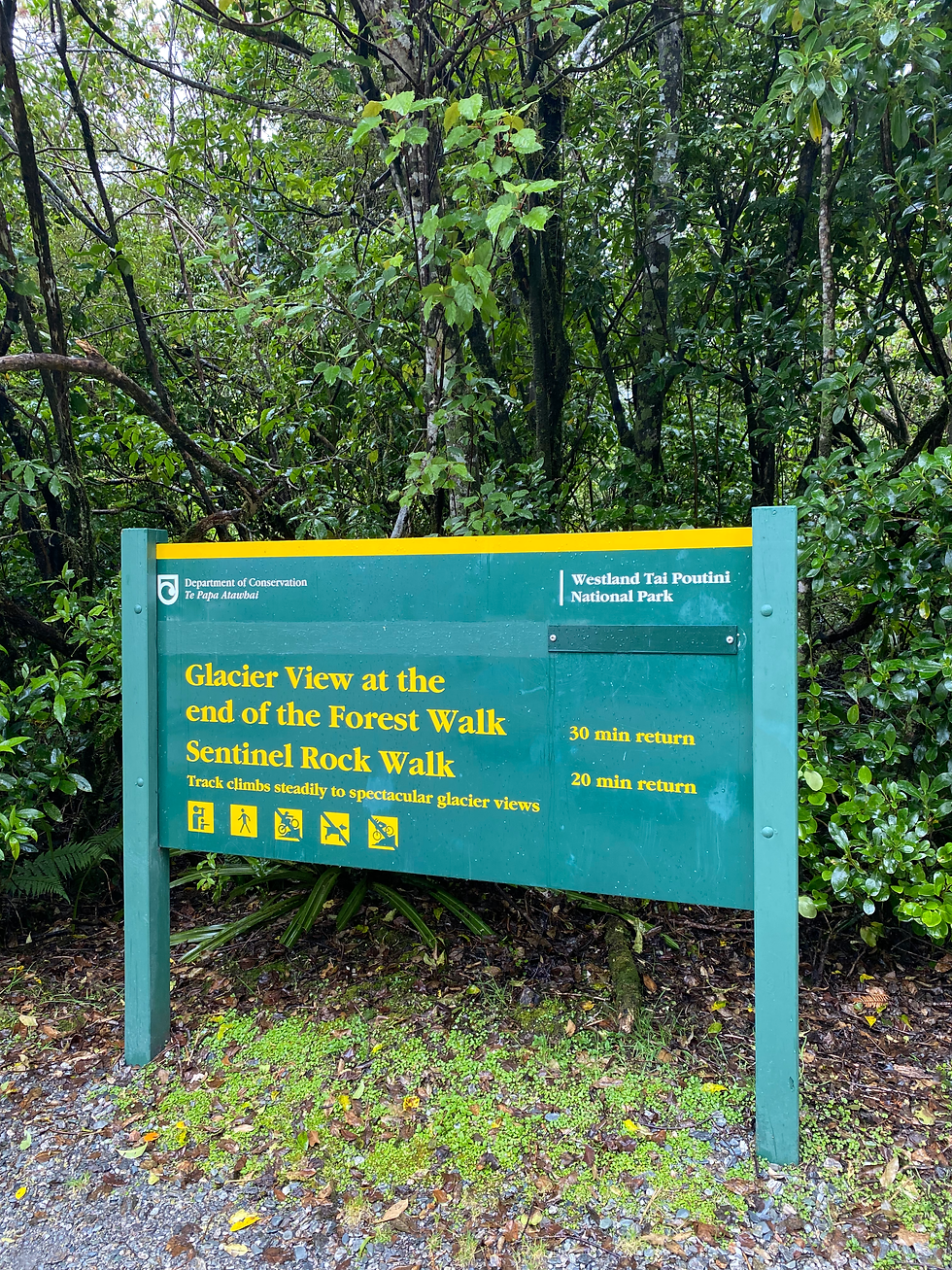
Forest Walk and Sentinel Rock: Franz Josef
Distance: 2km (out and back)
Time: 30 mins - 1 hour
Elevation gain: negligible
Car-free access? Yes
Two easily accessible hikes to see Franz Josef Glacier are the Forest Walk and Sentinel Rock Walk. They are both right next to each other and neither takes longer than 15 minutes to the viewpoint. There are lots of little paths in this area, and you can also walk to these trailheads from town in about 45 minutes.
Queenstown Hill: Queenstown
Distance: 5km (out and back)
Time: 2-3 hours
Elevation gain: 399m
Car-free access? Yes
Queenstown Hill is a short and easy hike behind Queenstown itself. You can walk to the trailhead from the city. It’s mostly forested until a bit higher up where you get views over Lake Wakatipu, Queenstown, and Ben Lomond.

The Best Moderate Day Hikes on New Zealand’s South Island
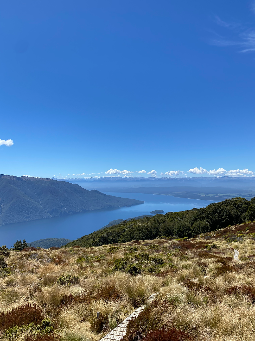
Mt Luxmore from Brod Bay: Te Anau
Distance: 25.3km (out and back)
Time: 5-7 hours
Elevation gain: 1321m
Car-free access? Yes
The Kepler Track, one of the Great Walks, starts pretty much in the town of Te Anau. Hiking the section of the track up to the summit of Mt Luxmore is a great day hike. You can take a water taxi across the lake to Brod Bay to shave off an hour of the walk if you are pressed for time or want to save your legs. Book this in advance through Kepler Water Taxi online - they have a boat every hour for the morning, and then back in the afternoons, and it costs NZ$25 per adult for a return trip.
The trail starts uphill in the forest until you break above the tree line about an hour in. From the tree line, it’s fairly flat to the Luxmore Hut, and then it’s incline up to the summit. The views up there are well worth the climb. The round trip for the hike (taking the water taxi) took me about 4.5 - 5 hours including lunch at the summit.
Abel Tasman Coastal Track: Bark Bay - Marahau
Distance: 24.6km (point to point)
Time: 7-9 hours
Elevation gain: 855m
Car-free access? Yes
If you aren’t doing the approximately 5 day hike along the Abel Tasman Coastal Track, you can do sections of it in day hikes. I decided to take a water taxi from Marahau to Bark Bay which cost NZ$55, and then walked from Bark Bay back to Marahau, which was around 24km, not including offshoot paths. It is a little bit up and down but is mostly flat so is not too strenuous. I have only put this as moderate because of the length.
The views along this trail are unreal, and the colour of the water is unmatched. There are several paths from the main track which take you to little beaches, coves, rivers, and viewpoints, and they are all incredible. It’s a very quiet area and I had most of the beaches to myself. Take your swim stuff! It is one of my favourite hikes ever.

The Best Difficult Day Hikes on New Zealand’s South Island
Roy’s Peak: Wanaka
Distance: 16.4km (out and back)
Time: 6-7 hours
Elevation gain: 1284m
Car-free access? No
If you’ve seen pictures of New Zealand, the view from the top of Roy’s Peak is probably one of them. I recommend doing this hike for sunrise. It takes about 2 hours to summit, and I’ve rated this as difficult because even though it is short, it’s a very steep climb. The trailhead is about a 10-15 minute drive from Wanaka. You can either drive or book a taxi from town to get there. Read more about this on my Wanaka blog. As expected, the golden hues of sunrise over Lake Wanaka and the mountains was incredible. Heading down took under 2 hours, and you can either drive back to Wanaka or walk back along the Glendhu Bay trail, although this will add another couple of hours to your morning.

Ben Lomond: Queenstown
Distance: 12.7km
Time: 5-7 hours
Elevation gain: 961m
Car-free access? Yes
It is a tough hike up to the top of Ben Lomond, the mountain that looms over Queenstown. It took me just over 3 hours to go up, and 2.5 hours down, from the bottom of the cable car (which you can reach on foot from Queenstown city). If you take the cable car up, you’ll shave off about an hour of the hike which covers the switchback section in the forest.
The trail to the saddle of Ben Lomond is well maintained and wide, but after that, it becomes a bit rougher and you’ll have a couple small scrambles in the last 45 minutes. The views from the top are worth it though, and you will see a lot more from the summit than if you just stop at the saddle.

The Best Day Hikes on New Zealand’s South Island Without a Car
If you’re travelling New Zealand without a car (which is absolutely possible, see my guide here), all of these hikes are still doable. You can either walk to the trailheads from the town, take a taxi, or book an organised tour.
How to get to the trailheads of these incredible hikes:
Hooker Valley Track: book a day tour from Lake Tekapo.
Mt John: walk from Lake Tekapo town, you can start from the lakefront.
Glendhu Bay: walk from Wanaka town, the trail starts from the lakefront.
Forest Walk and Sentinel Rock: walk from Franz Josef town. The walk is about 45 minutes along the road, but is flat and easy.
Queenstown Hill: walk from Queenstown, the trail starts from the edge of the city.
Mt Luxmore: either walk from town and start at the lakefront, or walk to the water taxi station at the lakefront and start where you get dropped at Brod Bay. Book the water taxi in advance through Kepler Water Taxi online - they have a boat every hour for the morning, and then back in the afternoons, and it costs NZ$25 per adult for a return trip.
Abel Tasman Coastal Track: Bark Bay - Marahau: walk from Marahau to the water taxi station and you will be taken to the trailhead at Bark Bay. Walk back into town from the end of the trail in Marahau. The water taxi from Marahau to Bark Bay cost NZ$55, and I booked it in person the day before.
Roy’s Peak: take a taxi from Wanaka town. I booked through Yellow Taxis the day before and it cost NZ$7 per person (4 people).
Ben Lomond: walk from Queenstown to the bottom of the cable car and start your hike there.

There are countless more day hikes to do on New Zealand’s South Island, but these are definitely my favourites. Don’t forget to check out my full New Zealand guide here for more hikes and my best advice for planning a trip! And as always, especially in nature, look after the places you visit and only leave your footprints behind :)


Comments