The Best Hikes in Tatra National Park, Poland

Updated: Sep 18
I spent 4 days in Tatra National Park, Poland, and I was absolutely blown away by the scenery there. The mountains, lakes, and forests were gorgeous, and compared with other hiking destinations, it was very quiet. Zakopane and the Polish Tatras are definitely the most underrated parts of Poland, and you have to go visit for yourself. While you could spend weeks here doing all of the hikes and activities, here is my list of the best hikes in Tatra National Park, including information on getting to trailheads, what to expect on the hikes, and more top tips and advice.

Contents
National Park Fees
Before you start any hike in Tatra National Park, you will need to pay the National Park entry fee. This costs 11 PLN (approx. £2.20) for one adult per day, or 45 PLN (approx. £9) for a week. You can buy these online in advance, but in my experience, paying at the Park entrance was very straightforward. You can use cash or card.

The Best Hikes in Tatra National Park, Poland
Hike 1: Morskie Oko
Morskie Oko is one of the most beautiful lakes in the Polish Tatras and one of the country's most popular hikes. Located just outside Zakopane in Tatra National Park, its crystal-clear water, dramatic mountain backdrop, and accessible trail make it a must-visit for anyone exploring southern Poland.
Hike Stats
Distance: 16 km return with an additional optional 4 km to Czarny Staw pod Rysami
Time: 3 hours return (4.5 hours return with hike to Czarny Staw pod Rysami)
Elevation gain: 420m (625m including the hike to Czarny Staw pod Rysami)

How to get to the Morskie Oko Trailhead from Zakopane
The trailhead of this hike is Palenica Bialczanska, the parking lot where you need to park to start the hike to Morskie Oko. It is very easy to get there by bus. There are numerous shuttle buses that go from the Zakopane central bus station, and they have Morskie Oko signs in them so you know which one to get on. You can’t miss them. The buses also stop at Jaszczurowka and a few other places along the route. If you’re not getting on at the Zakopane bus station, just flag down the bus at your stop.
The first buses in the summer leave from Zakopane central around 6am. It varies depending on the day, and there is no set timetable, as the buses leave when they are full. My best estimate is that every 20 minutes there will be another bus, so you won’t wait long. They fill the buses up completely, so you may be standing or even sitting in the doorway (as I was). This is especially the case if you get on later on the journey. The whole ride is about 30 minutes long.
The bus costs 15 PLN (approx. £3) one-way, and they only accept cash. Normally you pay when you get off the bus.

What to Expect on the Morskie Oko Hike
The 8km trail from the parking lot at Palenica Bialczanska to Morskie Oko is all tarmac. It’s a very easy walk with not much incline (420m elevation gain), but you get beautiful views of the mountains. There are some signposted shortcuts you can take, and these are not paved, but will save you a good amount of time. All along the tarmac road there are porta loos for your convenience.
Prepare to be wowed by the views when you get to Morskie Oko - it is absolutely stunning. In the summer, and especially on weekends, it gets busy, but you will still have uninterrupted views of the lake and mountains surrounding it. I arrived at 8:15am and it was not too crowded yet, the lake was still, and the sun was on it, which made it beautiful.
At Morskie Oko there is a hut with a restaurant, bar, rooms, and toilets. You can refill your water bottle here with tap water for free. Toilets cost 4 PLN (approx. £0.80), but they are really clean so it’s worth it in my opinion! You will also find bins here, including recycling, so please use them if you have waste.
There is a trail that goes around the lake, and a short one that goes up behind it to Czarny Staw pod Rysami, another lake at the foot of Rysy, the highest mountain in Poland. This one is also absolutely gorgeous and is much less visited than Morskie Oko. I would really recommend doing this if you can.
For a complete guide to the Morskie Oko hike, have a read of my post here. I combined it with the Five Polish Ponds Valley, which you can read about below.

Hike 2: Five Polish Ponds Valley (Dolina Pieciu Stawow Polskich)
The Five Polish Ponds Valley is an iconic place in the Polish Tatras. I combined this with Morskie Oko for a mega hike, and it was undoubtedly my favourite.
Hike Stats
Time: 8 hours (including Morskie Oko and Czarny Staw pod Rysami
Distance: 29.4km
Elevation gain: 1330m
How to get to the Five Polish Ponds Trailhead from Zakopane
The trailhead for this hike is the same as for Morskie Oko, so you can read about that above. The only difference is that before you get to Morskie Oko, you will see a turnoff for this trail to your right. Take this trail and begin your ascent up to the pass before the lakes.
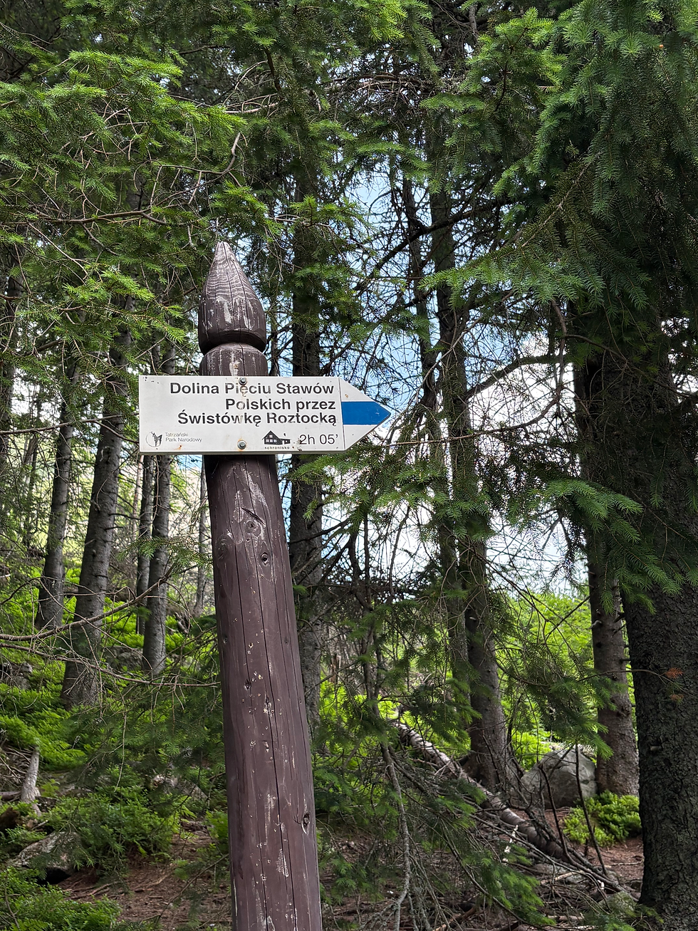
What to Expect on the Five Polish Ponds Valley Hike
The incline after the turnoff from the tarmac road is steady, but you will get great views of Morskie Oko if you look back. It takes you over the top of one mountain, down a little bit, then over another before the final descent to the next hut: Schronisko PTTK w Dolinie Pięciu Stawów Polskich. It’s not an easy climb, but the views of the Polish Ponds are incredible.
This hut is really nice. It has a restaurant, bar, rooms, kitchen, and toilets. You can fill your bottle up here with tap water for free as well, and toilets again cost 3-4 PLN (approx. £0.80). It’s a great place for a rest right by the lakes.
Once you get there, you can walk around the lakes. There are some trails to small peaks and one to a waterfall. You can decide which one to do, and then return to the hut before the descent. I decided to walk to the third large lake, Czarny Staw Polski, which was gorgeous. It’s much quieter here than at Morskie Oko, and I absolutely loved it.

From the hut at the Five Polish Ponds, you will start your descent back to the trailhead, following the signs for Dolina Roztoki. The descent through the valley starts steep but then just becomes a steady walk. It is absolutely stunning with views of trees, rivers, and the mountains behind. Even though I got some rain at this point, I loved this section.
After about an hour, you will rejoin the tarmac road that you started the day on. It’s about 30 minutes from there to the parking lot, where you will exit the National Park and get on a bus back to Zakopane. If you need to get off the bus earlier, tell the driver, and be prepared to shout when it’s your stop. The drivers don’t speak much English, so you need to be confident!
You can read more about this hike in my complete guide here.

Hike 3: Kościelec and Czarny Staw Gąsienicowy
The hike from Kuźnice to Czarny Staw Gąsienicowy and Kościelec is a popular trail in Tatra National Park, and for good reason. The stunning Hala Gąsienicowa and lake will blow your mind, and if you head up to Kościelec, the view from the top is incredible. For this trail, I recommend following the All Trails route called ‘Kuznice - Koscielec’.
Hike Stats
Time: 5.5 hours
Distance: 17.9km
Elevation gain: 1412m

How to get to the Kościelec and Czarny Staw Gąsienicowy Trailhead from Zakopane
The trailhead of this hike is in Kuźnice, the bottom of the main cable car in Zakopane. You can get there by using the city buses, tourist shuttle buses, taxi, or walking.
The city bus will be one of your cheapest options. You can pay by cash or card on the bus when you get on - there are machines onboard. A one-way journey costs 6 PLN (approx. £1.20), or you can buy a 24 hour ticket for 8 PLN (approx. £1.60). Make sure you validate the ticket on the bus.
The tourist shuttle buses leave from Zakopane central bus station and go to Kuźnice every 10 minutes or so. While there is a timetable, it is not very accurate in the summer as they put on multiple buses and they just cycle around. It’s not a long drive, so you won’t be waiting long. These buses are cash only, and you normally pay the driver when you get off the bus. The tickets cost 5 PLN (approx. £1) one-way.
Uber and Bolt are the main taxis in Zakopane, and they are very cheap as well. If you’re planning on starting this hike early in the morning, this will be your best option. I paid 17 PLN (approx. £3.30) for a 5 minute drive at 5:15am, which I thought was very reasonable.
Depending on where you are staying, you can also walk to Kuźnice. Just follow Google Maps to get you there.

What to Expect on the Kościelec and Czarny Staw Gąsienicowy Hike
The hike begins with a steady climb up to Hala Gąsienicowa, a beautiful valley filled with mountain huts and grasses and surrounded by tall pine trees and the stunning mountains. This is your first landmark on the hike, and it was one of my favourite parts. In the morning sun, this place is gorgeous.
There is a hut called Schronisko PTTK Murowaniec just below the valley - follow the signs to it when you get to the crossroads. Here there is a sink where you can refill your water bottle with tap water for free, get food at the restaurant, buy drinks and snacks, and use the toilet. Toilets here cost 4 PLN (approx. £0.80), but they are very clean and therefore worth it!
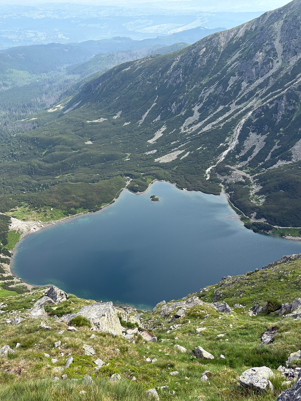
From the hut it is only around 30 minutes to the lake: Czarny Staw Gąsienicowy, and it’s not a difficult climb. You will be rewarded with stunning views of the clear blue water surrounded by some incredible peaks. If it is raining or icy and you do not have adequate equipment, please stop the hike here and go back, as the next section is extremely dangerous in wet or slippery conditions.
If you’re looking at the lake, to your right is the trail that goes up to Kościelec. It is signposted as ‘Karb’ as this is the halfway point to the peak. The section to Karb is steep but manageable, and you’ll find yourself walking along a short ridgeline with great views of Czarny Staw Gąsienicowy and the smaller lakes on the other side of the ridge. This was probably the best view of the hike.

Important: The final climb from Karb to Kościelec is an exposed mountain scramble rather than a normal hiking trail. If you are uncomfortable with heights or have little scrambling experience, I'd recommend turning around at Karb. You'll still enjoy some of the best views in the Polish Tatras without tackling the most technical section.
Once you get to Karb, you’ll see the path down to your right as well as the trail up to the top of Kościelec. If you don’t want to tackle Kościelec, going down is a great option. The trail up to Kościelec peak is no joke! It’s very challenging, steep, and at some points technical. I did not expect this, but it was my fault for not reading more about it beforehand. The view from the top is incredible.
Going back down from Kościelec to Karb is just as scary as going up, so please take your time. You may need to sit and slide at some points. When you get to Karb, turn left and go down in the direction of the lakes. This section is absolutely gorgeous and so quiet - I basically had it to myself. The lakes are so still and it’s a surreal setting.
You can stop at the same hut again to refill water, get food, or use the toilets if you need, and then continue back down to Kuźnice. You will hit another crossroads, and again I recommend turning left here so that you are going down a different path to the one you came up on. It starts a bit steeper, but then flattens out nicely and you will be walking through beautiful meadows at the end, which is a much more relaxing finish to the hike.
You can read my complete guide to this hike here.
Hike 4: Sarnia Skala, Nosal, and Kopieniec Wiekli
I call this the three peak hike, but it can be split into several shorter hikes that just tackle one at a time. It encompasses Sarnia Skala, Nosal, and Kopieniec Wielki. It was not too difficult but still provided great views of the mountains and even goes past the Wodospad Siklawica waterfall.
Hike Stats
Time: 6 hours
Distance: 23km
Elevation gain: 1500m

How to get to the Trailhead of the Sarnia Skala, Nosal, and Kopieniec Wielki Hike from Zakopane
The trailhead for this hike is reachable by city bus - these are the blue ones. There is a bus stop right outside it and another a 15 minute walk away. Where you are staying will determine the best route for you to get there, and I recommend checking Google Maps for this.
You can pay by cash or card on the bus when you get on - there are machines onboard. A one-way journey costs 6 PLN (approx. £1.20), or you can buy a 24 hour ticket for 8 PLN (approx. £1.60). Make sure you validate the ticket on the bus.

What to Expect on the Sarnia Skala, Nosal, and Kopieniec Wielki Hike
From the trailhead, you will start with a steady but gentle ascent to the waterfall: Wodospad Siklawica. It’s actually off a little offshoot path which is signposted, and it took me about 30 minutes to get there from the trailhead. It’s not a huge falls but when I went it was very quiet there, which was lovely. Be careful on the trail, however, as it gets slippery, especially after rain.
Head back down to the crossroads and follow the signs to Sarnia Skala, your first peak. It isn’t a high peak, which means you can get to the top from the crossroads in around 45 minutes depending on how fast you walk. I found this section quite steep but it was such a rewarding view at the top, and I loved it.

On your way down from Sarnia Skala, turn left and follow the trail that traverses the mountain. It’s a really beautiful section. After a short descent, you’ll reach a crossroads. If you want to cut the hike short here, turn left and walk back into town. To continue the hike, keep going straight and head to Kuznice. On the way you’ll have great views of the mountains and a very quiet trail. I only saw a handful of people on this section. Before you reach Kuznice, you will see signs for Kalatowki hut. It’s a great place to stop for food, toilets (3 PLN, approx. £0.60), and water - they provide free tap water refills. There are also plenty of picnic benches overlooking the valley which is gorgeous. From Kalatowki hut, it’s a short descent to Kuznice. You can very easily end this hike here as well, as you’re in the centre of town.
You will exit the park at Kuznice and have to re-enter, but you can show your receipt and you don’t have to pay the entry fee again. At the entrance, follow the signs to Nosal, your second peak. It’s not a long climb up to the peak from the entrance hut, only around 25-30 minutes. It’s steady and very manageable, and you’ll gain only 200m of elevation. The views at the top are great: you can see Zakopane on one side and a vast stretch of mountains on the other. I really liked this peak.

On your way down from Nosal, turn left and follow the signs down to Olczyska Polana and Dolina Olczyska. You’ll walk down through a beautiful valley and then follow the river to a bridge and crossroads. At this point, you can either turn left and end the hike at Jaszczurówka, or turn right and head up towards Kopieniec Wielki and Polana Kopieniec.
However, I recommend heading up to Kopieniec Wielki - it was my favourite! It’s a steady climb with one steep section at the end. Polana Kopieniec breaks up the steep bit with a gorgeous meadow filled with wooden mountain huts. In July and August the flowers here are pink and it’s stunning, especially in the evening or morning light.
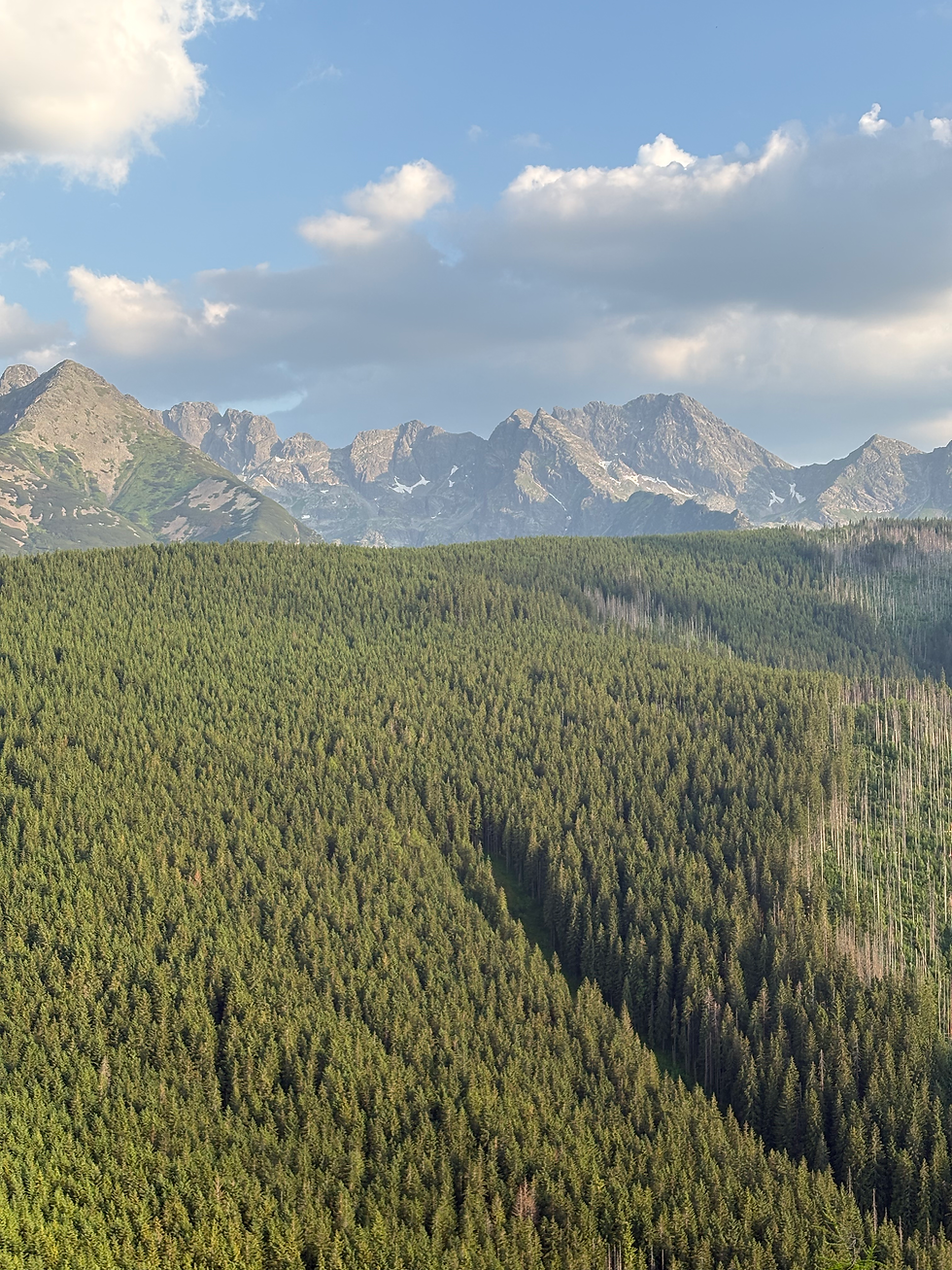
The last stretch up to the top of your third peak, Kopieniec Wielki, is short and steep, but you are rewarded with some incredible views of some of the Tatra peaks beyond the forested hills. This peak was a lot quieter than Nosal, and slightly more wild as you can’t see Zakopane from it. I absolutely loved this one.
From the peak, you can head back down the same path you came up and continue down along the river all the way to Jaszczurówka. It’s a very easy walk down. There is a bus stop right as you exit the National Park that takes you back into the centre of Zakopane, or you can walk - it’s only about 3km.
For a complete trail guide for this hike, see my post here.
I hope this inspires you to complete some of these hikes, they are undoubtedly the best in Poland’s Tatra National Park. As always, please look after the places you visit. Take all your rubbish out with you or use the recycling and waste facilities on the trails, and remember to only leave your footprints behind :)
Want full trail guides to my favourite hikes in the Polish Tatras? Check them out here:


Comments